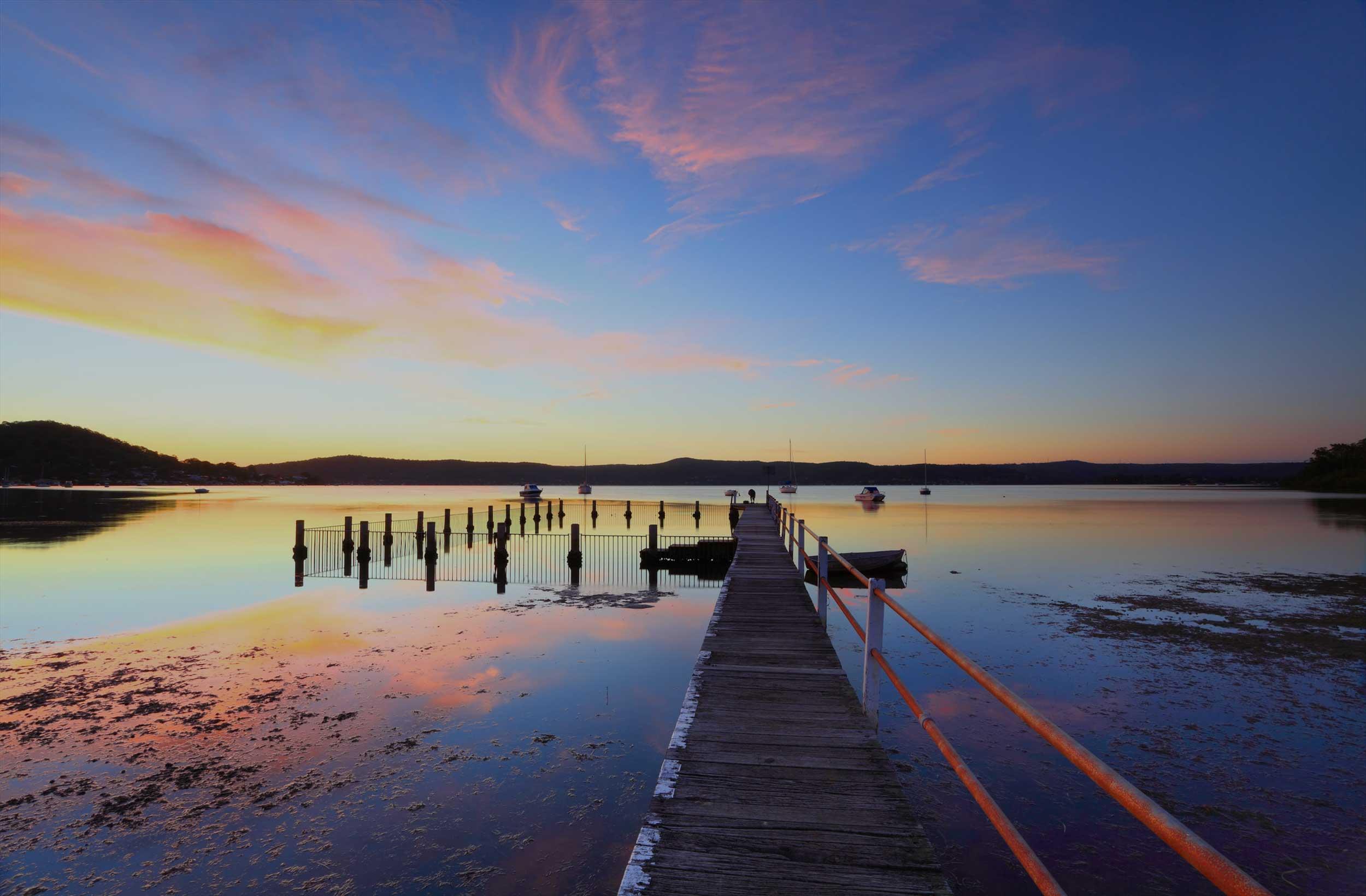
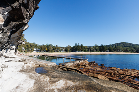
Pearl Beach Lagoon is a small and mostly closed coastal lagoon on the NSW Central Coast. The lagoon is a dynamic ecosystem that can vary between freshwater, brackish and saltwater environments and has historically, on occasion been completely dry. It is a unique feature of the local area and there are no comparable environments nearby.
This project aims to address three key management actions identified in the Coastal Zone Management Plan for Pearl Beach Lagoon relating to hydrological and sedimentary processes.
What is the aim of the Pearl Beach Coastal Zone Management Plan implementation project?
The project will investigate and design management activities to address three of the nine management actions outlined in the Pearl Beach Lagoon Coastal Zone Management Plan (CZMP). These three actions have the overriding aim of improving the health of Pearl Beach Lagoon.
- Retrofit Stormwater Quality Improvement Measures(External link) (CZMP Action 4).
- Investigate Options to Modify the Weir(External link) (CZMP Action 8).
- Investigate Options to Remove Sediments from the Lagoon (External link)(CZMP Action 9).
How and why did we choose these actions we are investigating?
This project aims to address three key management actions identified in the Coastal Zone Management Plan for Pearl Beach Lagoon. These actions (4, 8 &9) all consider hydrological and sedimentary processes and as such, it is more efficient to investigate them at the same time.
At the completion of this project, Council will have the necessary documentation to enable implementation of on-ground works associated with action 4 and will have preferred options for actions 8 and 9.
What stage is the project presently at?
Council has engaged a team led by coastal and environmental consultants from Salients to undertake detailed site investigations, including
- surveying the ecology around the lagoon
- surveying the depths of the lagoon
- collecting sediment samples from the bed of the waterway.
The study team is now seeking input from the Pearl Beach community to understand the way you would like to see the lagoon managed to address the three actions being investigated.
How can I provide input?
Due to the current restrictions on non-essential public gatherings resulting from the present COVID-19 pandemic, Council has moved community engagement activities to online. The following mechanisms are provided for the community to be involved:
- An interactive map(External link) has been established to allow members of the public to identify locations on the map and to attach comments for review by the study team. These comments may include details on how and where a management option could be implemented, or a recent observation relating to a location.
- An online forum where three topics have been established to enable the community to discuss details around the three management actions that are being addressed as part of this stage of the Project. This forum is being overseen by Council and, where appropriate, points raised will be addressed by the study team.
If neither of these options suit, more conventional written feedback can be provided by emailing study representatives from Council and/or the Salients study team, using the addresses provided under “Who’s Listening”
When will the Project be completed?
The work being completed by Salients will be completed by the end of 2020. This is just the initial phase of the project and work will be ongoing throughout 2021.
How will the project progress the retrofitting of stormwater quality improvement measures?
A draft stormwater quality management strategy was prepared during development of the Pearl Beach Lagoon CZMP. A review of that strategy is being undertaken, supported by a study of historical data, background documentation and site inspections. This review will inform the development of design concepts. Council will undertake further community engagement around the options and take this into consideration along with a range of other factors including cost, maintenance requirements and computer modelling.
Once a preferred option is selected construction drawings and environmental impact assessment will be prepared such that funding can be sought and the project implemented.
How will the project investigate options relating to modifying the weir?
Computer modelling will be undertaken to investigate the degree to which the weir impacts the lagoon. Alongside information from the community this will identify feasible options for weir management (e.g. modification or removal). This part of the project will result in the recommendation of a preferred option, designed to a conceptual level of detail. Further analysis and design may be required before this option could be implemented.
Will the weir be removed?
Given that the impacts of the weir are presently not well understood, a decision has not yet been made regarding the fate of the weir. There are differing opinions surrounding the advantages and disadvantages of the weir. The weir was constructed around 1990 to prevent the lagoon from drying out, prior to which there were concerns about odours and the loss of bird habitat. However, it is also possible that the weir has degraded ecological values by changing the natural flushing of the lagoon and causing sediment to settle in the lagoon. The full extent of the weir’s impact on water quality is uncertain, although it appears that conditions within the Lagoon are becoming increasingly ‘fresh’.
This project will examine and assess potential management options, which may include removal of the weir or alternatively modification such as raising, lowering, or reconfiguration with an adjustable structure.
How will the project investigate options relating to the removal of sediment?
Catchment development has accelerated sediment deposition within the lagoon, particularly at three main stormwater outlets to the west of the lagoon. The study team is presently considering the best management options for the types of sediment present considering engineering, environmental and legal constraints.
Will sediment be removed?
A decision has not yet been made regarding whether sediment can be removed or should remain in situ. The recommended management strategy will depend on factors such as whether the material can be legally disposed of, and if its removal (or leaving in place) will cause further problems, such those associated with acid sulfate soils.
What are acid sulfate soils?
Acid sulfate soils (ASS) are sediments which commonly occur in low lying, marshy or swampy areas and can generate acid if they dry out. These sediments remain non-acidic if they aren’t exposed to oxygen by, for example, being excavated or drained (in this state they are known as “potential acid sulfate soils”). However, when they dry out and become exposed to the air, some chemicals in the sediments (such as iron pyrite) generate acid once they are “oxidised”. The soils are then known as “actual acid sulfate soils”. If rewetted, acid is generated by actual acid sulfate soils and enters waterbodies, causing a range of very undesirable impacts such as killing fish and plants.
Are acid sulfate soil materials present in the lagoon?
Preliminary investigations of sediment within the lagoon indicate that potential acid sulfate soil (PASS) is widespread. This means the soils needs to be carefully managed and some options for disposing of the sediment are likely to be very expensive.